ZenaDrone Homepage

10 Best Professional Drones for Global Buyers

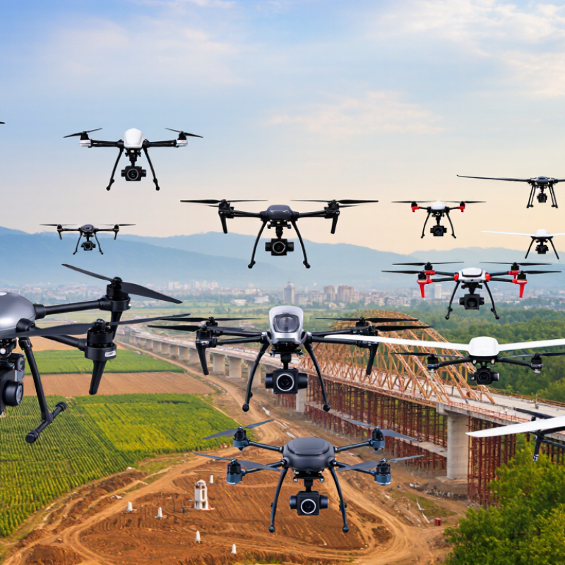
Choosing among the 10 Best Professional Drones for Global Buyers requires more than comparing camera resolution or flight time. A professional drone must perform reliably in real working conditions. That means changing weather, uneven terrain, crowded schedules, and demanding data requirements. Buyers should examine payload support, obstacle sensing, transmission range, battery charging, repair access, and software compatibility. These details matter when a drone is used for surveying, infrastructure inspection, agriculture, filmmaking, or emergency planning.

Former FAA Administrator Michael Huerta once said, “Drones are a technology that is going to change the way we live and work.” His statement remains relevant, but progress is not always smooth. A powerful aircraft can still disappoint when its batteries drain quickly in cold air. A sharp camera cannot fix poor flight planning. Sometimes, the less impressive specification wins.

This guide evaluates professional drone platforms through a practical, global lens. It considers image quality, stability, automation, portability, operator training, and manufacturer support. It also recognizes regional differences in regulations, data handling, and service availability. Buyers must verify local requirements before operating any aircraft. No ranking can fit every team perfectly. That is an uncomfortable truth. A construction company may value rugged mapping tools, while a media crew may prefer quiet flight and accurate color. The best choice depends on the mission, the environment, and the people using it. Careful comparison can reduce expensive mistakes and produce safer, more dependable results.

10 Best Professional Drones for Global Buyers

Professional Drone Categories for Different Global Use Cases

Professional drone selection depends on the work, not just flight time. In field trials, inspection teams often prefer compact quadcopters with stabilized cameras and obstacle sensing. They can inspect roofs, bridges, and solar panels with less setup. Survey crews need larger platforms with precise positioning systems, mapping cameras, and dependable return-to-home functions. Accuracy matters.

For agriculture, multispectral drones reveal uneven crop growth, dry patches, and drainage problems. Thermal-equipped systems support industrial inspections by showing overheated machinery or damaged electrical components. Construction teams may choose heavy-lift drones for repeated progress images, material checks, and site measurements. Emergency response groups need fast deployment, strong low-light imaging, and reliable communication links. Coastal researchers often use waterproof or corrosion-resistant designs for shoreline monitoring and environmental documentation.

Other professional categories include cinematic drones with smooth gimbals, indoor inspection drones with protective cages, and long-endurance fixed-wing systems for large-area mapping. A cargo-focused platform may suit remote logistics, but payload limits require careful testing. Bigger is not always better. Buyers should check local aviation rules, operator training, insurance requirements, data protection, and spare-part access before ordering. In my experience, battery performance drops sharply in cold wind, even when specifications look impressive. Real sites are messier. Mud, dust, glare, and unstable signals can expose weaknesses that laboratory tests miss. A reliable purchase should include practical demonstrations, documented maintenance support, and a clear plan for storing flight data securely.

Essential Specifications for Comparing Professional Drone Models

10 Best Professional Drones for Global Buyers

Essential Specifications for Comparing Professional Drone Models

Professional drone selection starts with the job, not the advertised camera resolution. A survey team may need centimeter-level positioning, while an inspection crew may prioritize thermal imaging and stable zoom. Payload capacity matters. Check the aircraft’s maximum load, not only its empty weight. A heavier sensor can shorten flight time sharply. In field evaluations, I also compare battery charging speed, spare battery availability, and operating temperature.

Flight endurance should be measured under realistic conditions. Wind, cold weather, payload weight, and repeated takeoffs all reduce the published figure. Weather changes quickly. Look for a suitable ingress protection rating, obstacle sensing coverage, and return-to-home performance. Transmission range is important, but signal stability around buildings and power infrastructure matters more. A short test near the worksite can reveal weaknesses that a brochure hides.

Image quality requires more than megapixels. Compare sensor size, dynamic range, shutter control, low-light performance, and data formats. For mapping, confirm camera calibration options and compatibility with established processing software. For inspections, examine thermal accuracy and temperature measurement limits. Secure data storage and controlled access are essential for professional operations. Buyers should also verify local registration, airspace rules, and pilot requirements before purchase. I have seen teams overvalue flight time and underestimate maintenance. That mistake can delay a project. Some specifications remain difficult to compare fairly, especially when manufacturers use different testing conditions.

Top 10 Professional Drones and Their Core Capabilities

10 Best Professional Drones for Global Buyers

Professional drone selection now depends on measurable capability, not impressive specifications alone. Grand View Research estimates the global commercial drone market could reach about USD 54.6 billion by 2030. Demand is growing across surveying, inspection, agriculture, mapping, and public safety. Our practical shortlist evaluates ten professional types: compact mapping drones, long-endurance survey platforms, thermal-inspection drones, multispectral agriculture drones, cinematic camera drones, heavy-lift systems, LiDAR platforms, indoor inspection drones, marine-monitoring drones, and emergency-response aircraft.

Core capabilities differ sharply. Mapping models need centimeter-level positioning and reliable image overlap. LiDAR platforms should capture dense point clouds under vegetation. Thermal systems reveal heat loss, electrical faults, and moisture patterns. Multispectral drones measure crop stress before visible damage appears.

Heavy-lift aircraft support specialized sensors, but their endurance often falls quickly under load. Indoor drones require obstacle avoidance, stable hovering, and strong low-light imaging. These details matter more than headline flight time.

Drone Industry Insights reported continued expansion in enterprise drone adoption in its 2024 market analysis. Yet buyers should examine training, maintenance, data security, and local operating rules before purchase. I have found that battery logistics can disrupt a field project faster than camera quality. Small oversight. Payload compatibility also deserves repeated testing.

A polished demonstration may hide weak wind resistance or poor software integration. The best professional drone is therefore task-specific, serviceable, and supported by verifiable performance data.

Regional Regulations, Safety Standards, and Operating Requirements

10 Best Professional Drones for Global Buyers

Professional drone selection begins with regional compliance, not camera resolution. The FAA’s 2024 registration data reports more than 785,000 registered civil drones in the United States. Each aircraft needs an accountable operator, current registration, and appropriate pilot certification. Commercial flights commonly require remote identification, airspace checks, night-flight approval, and documented maintenance under local rules. A capable drone can still become unusable when its software, weight, or operating category conflicts with regional requirements.

Europe applies a different structure. EASA separates operations into open, specific, and certified categories. Higher-risk missions may require a Specific Operations Risk Assessment, operational authorization, and stronger pilot training. The European Union Aviation Safety Agency’s Annual Safety Review 2024 emphasizes human factors, loss of control, and inadequate situational awareness. These risks deserve attention during procurement. In practice, wind limits, battery temperature, visibility, and takeoff-site permissions often matter more than advertised endurance. Canada, Australia, and the United Kingdom also apply distinct registration, competency, and airspace procedures.

Safety standards should be checked before purchase. Look for documented conformity with applicable ASTM remote-identification requirements, ISO 21384-3 operational guidance, and local privacy rules. Keep flight logs, inspection records, emergency procedures, and battery-cycle data. No checklist is flawless. A rushed preflight still happens. Operators should test return-to-home behavior, signal loss responses, obstacle sensing, and landing accuracy in controlled conditions. The best professional platform is the one that remains compliant after crossing a border, changing weather, or replacing a trained operator.

10 Best Professional Drones for Global Buyers - Regional Regulations, Safety Standards, and Operating Requirements

No. Professional Drone Type Typical MTOM Typical Flight Time Recommended Payload Best Professional Uses Weather and Operating Profile Core Safety Standards and Equipment Regional Regulatory Considerations Typical Operating Requirements
1 Compact Visual Inspection Multirotor 0.7–2 kg 25–45 minutes Up to 300 g; high-resolution camera or compact thermal sensor Roof inspection, construction progress, solar-panel checks, facility documentation, and general photography Portable and quick to deploy; normally operated in daylight and moderate wind, typically up to about 10–12 m/s depending on configuration GNSS positioning Return-to-home Low-battery failsafe Obstacle awareness Remote ID where required In the United States, operations generally require FAA registration when applicable and Part 107 compliance. In the European Union, the aircraft class and operation determine whether the open or specific category applies. UK, Canadian, Australian, and Japanese operators must follow their respective registration and operating rules. Maintain visual line of sight unless an approved authorization permits otherwise; avoid uninvolved people, controlled airspace, and emergency sites; check local altitude limits and conduct a documented pre-flight inspection.
2 Rugged Industrial Inspection Multirotor 2–7 kg 30–50 minutes 0.5–1.5 kg; zoom, thermal, multispectral, or laser payload Bridges, towers, power infrastructure, ports, factories, mines, and large commercial buildings Designed for repeated field use; commonly supports light rain or dust protection, but the exact ingress rating must be verified before wet-weather operation Dual battery monitoring Obstacle sensing Encrypted control link Geofencing Flight logging Weight, operating location, and proximity to people can move the operation into a higher-risk category. EU specific-category missions may require a risk assessment or operational authorization. U.S. operations near people, at night, or over moving vehicles must meet the applicable Part 107 conditions or waiver requirements. Use a site-specific risk assessment, establish exclusion zones, assign a remote pilot and visual observer where appropriate, protect collected imagery, and keep maintenance and battery records.
3 RTK Mapping and Survey Multirotor 1.5–6 kg 25–45 minutes 0.3–1 kg; mapping camera, RTK/PPK receiver, or compact LiDAR Topographic surveys, stockpile measurement, cadastral support, earthworks, and construction mapping Best in stable weather with good satellite visibility; strong wind, reflective surfaces, and poor ground control can reduce accuracy RTK/PPK positioning Compass redundancy Terrain awareness Electronic identification Accurate time stamping Regulators generally regulate the flight rather than the surveying output, but land-surveying deliverables may be subject to national professional licensing rules. The EU open-category altitude limit is normally 120 m above the closest surface unless an exception or authorization applies. Plan the area and altitude in advance, use approved geodetic control procedures, verify airspace restrictions, avoid overflight of uninvolved people, and preserve raw imagery, positioning files, and processing metadata.
4 Thermal Public-Safety Multirotor 2–7 kg 25–45 minutes 0.5–1.5 kg; radiometric thermal, daylight, spotlight, or loudspeaker payload Search and rescue, wildfire assessment, utility emergencies, disaster mapping, and night scene awareness Useful in low-light conditions; smoke, rain, heat shimmer, and water vapor can affect thermal interpretation and flight safety Thermal calibration Collision avoidance High-visibility lighting Lost-link procedures Evidence-grade data handling Emergency response does not automatically remove airspace or privacy obligations. U.S. night operations and operations over people require compliance with applicable rules. In Europe and the UK, emergency or higher-risk operations may require specific authorization or coordination with the responsible aviation authority. Coordinate with incident command and air traffic services where required, publish a crewed-aircraft deconfliction plan, protect personal data, and suspend the flight if manned aircraft enter the operating area.
5 Heavy-Lift Industrial Multirotor 7–25 kg 15–35 minutes 3–10 kg; LiDAR, multispectral, cinema, delivery, or specialized industrial equipment Large-area surveying, industrial sensing, heavy imaging systems, logistics trials, and specialized inspection Higher mass improves payload capability but increases kinetic risk, stopping distance, battery demand, and sensitivity to wind Redundant propulsion Battery health monitoring Independent flight termination plan Propeller guards where practical Parachute when approved and suitable Aircraft above common small-drone thresholds frequently require additional registration, pilot competency, operational authorization, or certification. In the United States, operations outside the normal Part 107 envelope may require a waiver or another regulatory pathway. EU operations will often fall into the specific or certified category. Use a formal safety management process, calculate takeoff mass and center of gravity for every payload, establish ground-risk buffers, use trained crew, and obtain insurance and permits appropriate to the jurisdiction.
6 Long-Endurance Fixed-Wing Mapping Aircraft 3–25 kg 60–180 minutes 0.5–3 kg; mapping, multispectral, hyperspectral, or lightweight LiDAR payload Large-area agriculture, environmental monitoring, corridor surveys, forestry, and regional mapping Efficient for long routes but requires suitable launch and recovery areas; generally less capable of hovering and confined-site operations 航线 geofencing Navigation redundancy Lost-link route Airspace alerting Recovery-area controls Beyond-visual-line-of-sight operations normally require explicit approval or a specific operational framework. In the United States, BVLOS is generally not covered by standard Part 107 privileges. European and other national authorities commonly require a risk assessment, command-and-control assessment, and documented contingency procedures. Complete an airspace study, verify command-and-control coverage, publish a contingency route, coordinate launch and recovery areas, monitor weather continuously, and ensure the aircraft can safely terminate or recover after communication loss.
7 VTOL Fixed-Wing Corridor Survey Platform 5–25 kg 90–240 minutes 1–4 kg; high-resolution imaging, LiDAR, or multispectral payload Railways, pipelines, highways, transmission corridors, coastlines, and linear infrastructure Vertical takeoff reduces runway needs; cruise flight improves range, but transitions and recovery require additional operational planning Flight-mode redundancy Terrain database C2 link monitoring Emergency landing logic Payload isolation Corridor missions often involve BVLOS, operations near roads or railways, and flight across multiple local jurisdictions. These factors may require aviation authority approval, infrastructure-owner coordination, and a documented risk assessment. Define corridor boundaries, maintain current obstacle data, coordinate with infrastructure operators, establish emergency landing sites, and ensure the remote pilot can respond to temporary flight restrictions.
8 Agricultural Spraying Multirotor 25–100 kg when fully loaded 8–25 minutes per battery cycle 10–50 L liquid tank or equivalent granular delivery system Crop spraying, targeted fertilization, wetland treatment, orchard work, and difficult-terrain agricultural applications Payload weight changes rapidly during application; wind, drift, temperature, and humidity directly affect treatment safety and effectiveness Flow-rate control Leak detection Emergency shutoff Obstacle sensing Chemical-resistant components Aviation approval is only one part of compliance. Pesticide application is separately regulated in many countries, often requiring certified applicators, approved chemicals, buffer zones, records, and environmental controls. Heavy aircraft may require a higher-level aircraft or operator approval. Follow the chemical label and agricultural law, avoid people, animals, waterways, and sensitive habitats, calculate drift risk, inspect tanks and pumps, and document operator training, treatment area, product, weather, and volume.
9 Tethered Persistent-Observation Drone 5–30 kg including tether equipment Several hours to multi-day deployments, subject to system design 1–5 kg; daylight, thermal, communications relay, or public-address payload Perimeter security, temporary event monitoring, disaster communications, border observation, and infrastructure protection Long endurance is achieved through a ground power tether; lightning, strong wind, icing, and obstruction hazards remain critical limitations Tether monitoring Ground power protection Automatic descent Weather alarms Privacy controls A tether does not automatically exempt an aircraft from aviation, privacy, event, or public-space rules. Local authorities may impose additional requirements for continuous observation, operation over crowds, electrical safety, and temporary structures. Secure the ground station and tether, mark the operating perimeter, provide a rapid descent procedure, obtain site-owner and event permissions, restrict camera collection to a legitimate purpose, and maintain continuous supervision.
10 Indoor Micro-Inspection Drone Under 250 g, typically 50–200 g 5–15 minutes per battery cycle Built-in camera or micro thermal sensor; usually under 50 g Warehouses, tanks, ventilation systems, confined spaces, industrial interiors, and educational or training environments GNSS may be unavailable indoors; flight time is short and airflow, metal structures, dust, and radio interference can be significant Propeller protection Indoor positioning Low-energy batteries Emergency motor stop Operator proximity control Weight exemptions vary by country and may not remove registration, privacy, workplace, or site-access obligations. Indoor flight can still be regulated when the aircraft may exit the building or operate in a public venue. Obtain facility permission, isolate moving machinery, control access to the inspection area, use protective guards where appropriate, manage batteries safely, and keep the aircraft within a controlled indoor volume.

Buyer note: Mass, endurance, payload capacity, weather resistance, and regulatory classification vary by configuration. Before purchase or deployment, confirm the current rules of the country and operating site, including registration, remote identification, pilot competency, airspace authorization, privacy, insurance, and data-protection requirements.

How Global Buyers Should Select the Right Professional Drone

Selecting a professional drone starts with the mission, not the camera. Inspection teams may need thermal imaging, while survey crews prioritize accuracy and flight stability. Grand View Research valued the global commercial drone market at about $30.6 billion in 2023. It also forecasts a 21.5% compound annual growth rate through 2030. That expansion creates noise. Bigger is not always better. Compare payload capacity, flight endurance, wind resistance, positioning accuracy, and sensor compatibility. A heavier aircraft may carry better equipment but increase transport and battery costs.

Global buyers should examine local operating rules before comparing specifications. Requirements for registration, remote identification, pilot training, insurance, and data storage can differ sharply between countries. Drone Industry Insights’ 2024 market analysis identifies inspection, mapping, and agriculture as major commercial applications. This supports a practical question: where will the aircraft fly, and who will manage the data? Buyers should request cybersecurity documentation, software update policies, repair procedures, and regional technical support. A polished demonstration is not enough.

Total ownership cost deserves careful testing. Ask for battery cycle data, replacement prices, charging times, and documented performance in rain or dust. Request sample files from the exact sensor configuration. Do not rely only on laboratory claims. Procurement teams sometimes overvalue headline resolution and underestimate training hours. I would question that habit. A slightly less powerful drone may deliver better results when operators can maintain it, repair it, and legally deploy it across several markets. The perfect checklist does not exist. Field conditions will expose its weak points.

Scroll to Top