



How to Choose a Professional Drone in 2026?
Choosing a professional drone in 2026 requires more than comparing camera resolution and flight time. The right model must match your work, environment, and operating habits. A survey specialist may value centimeter-level positioning, while a filmmaker may prioritize dynamic range, lens options, and stable tracking. Inspect the entire system, not only the aircraft.
Real field experience reveals important details. A drone can advertise a long flight time, yet wind, cold weather, and payload weight may reduce it sharply. Battery health, obstacle sensing, transmission stability, and repair support often matter more than impressive specifications. Test the controller in bright sunlight. Check whether the screen remains readable. Listen for unclear alerts. Small inconveniences become serious during a six-hour inspection.
Reliability matters most.
Professional users should also verify local registration, airspace requirements, privacy rules, insurance expectations, and commercial operating permissions before each project. Standards and manufacturer policies may change during 2026, so official aviation authorities and product documentation deserve priority over online claims. Security features, encrypted data handling, and controlled access should receive careful attention, especially for infrastructure or public-sector work.
There is no perfect drone. Even experienced operators can overvalue new features and underestimate maintenance costs. I have seen advanced systems sit unused because setup was too complex for the team. This guide compares practical performance, ownership costs, safety tools, and support quality. Its goal is not to recommend the most expensive aircraft, but to help you choose a professional drone that performs consistently when conditions become demanding.
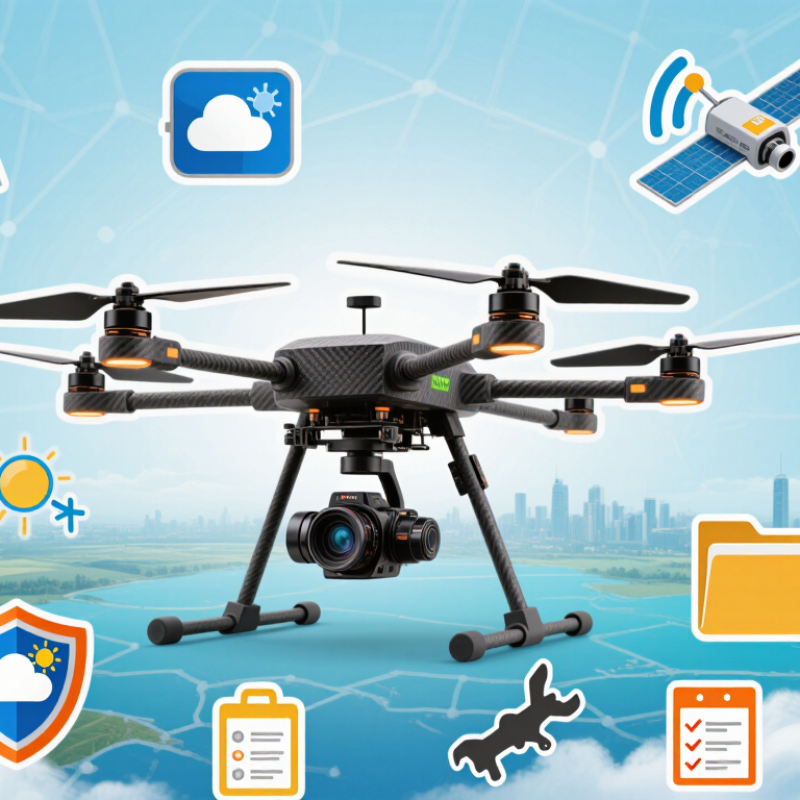
Define Your Mission, Budget, and Professional Drone Requirements
How to Choose a Professional Drone in 2026?
Define Your Mission, Budget, and Professional Drone Requirements
Choosing a professional drone starts with the job, not the camera. Map the real mission: surveying rooftops, inspecting towers, filming construction, or capturing farmland data. Each task demands different endurance, sensors, stability, and portability. A compact aircraft may suit indoor inspections, while long-distance mapping needs stronger navigation and reliable battery performance. Write down the required altitude, flight duration, payload, image resolution, and operating environment.
Set a complete budget, not only a purchase price. Include spare batteries, chargers, memory storage, protective cases, software, training, insurance, and scheduled maintenance. My early estimates were too optimistic. Battery replacement and data processing became larger costs than expected. Plan for weather delays and equipment downtime. Leave room for them. A cheaper system can become expensive when its workflow is slow or its parts are difficult to service.
Professional requirements should also cover evidence quality and operational control. Look for accurate positioning, obstacle awareness, secure data handling, return-to-home reliability, and clear flight logs. Test image quality in low light, wind, and uneven terrain before committing. Ask whether one trained operator can manage the aircraft safely. Review current aviation rules, local permissions, privacy duties, and restricted areas before every project. Practical experience matters, but it can create overconfidence. A written checklist, documented risk assessment, and independent training can expose mistakes that familiar hands overlook.
How to Choose a Professional Drone in 2026? - Define Your Mission, Budget, and Professional Drone Requirements
| Mission Type | Typical Operating Area | Recommended Aircraft Configuration | Practical Flight Time | Payload Requirement | Sensor Package | Positioning and Data Accuracy | Essential Safety Features | Indicative Professional Budget |
|---|---|---|---|---|---|---|---|---|
| Real Estate and Construction Progress | Urban and suburban sites with frequent takeoff and landing | Compact multirotor with a stabilized camera and obstacle sensing | 25–40 minutes per battery under normal conditions | Integrated camera; no external payload usually required | High-resolution RGB camera, preferably with mechanical stabilization | Satellite positioning for repeatable routes; ground control points when survey-grade outputs are needed | Return-to-home, obstacle detection, geofencing support, low-battery protection, and visible status lighting | Approximately US$1,500–US$5,000 for the aircraft, controller, batteries, and essential accessories |
| Surveying and Mapping | Open land, infrastructure corridors, quarries, and large worksites | Multirotor for compact areas or fixed-wing/VTOL aircraft for larger coverage | 30–55 minutes for multirotors; up to about 90 minutes for selected VTOL designs | Survey camera or interchangeable payload mount | High-resolution RGB camera; optional multispectral or LiDAR payload for specialized work | RTK or PPK positioning; centimeter-level relative accuracy is achievable with correct ground control and workflow | Terrain awareness, obstacle avoidance, wind tolerance, redundant navigation data, and reliable mission planning | Approximately US$5,000–US$25,000, excluding advanced LiDAR systems and specialist software |
| Infrastructure Inspection | Bridges, towers, roofs, pipelines, power facilities, and industrial assets | Weather-resistant multirotor with a three-axis stabilized camera and zoom capability | 30–45 minutes per battery, depending on wind and payload | Dual-camera or multi-sensor gimbal; optional spotlight or loudspeaker | Wide-angle RGB, optical zoom, and optional radiometric thermal camera | Stable navigation and accurate position logs; RTK is useful for repeat inspections but does not replace image quality | Obstacle avoidance, strong wind resistance, signal redundancy, emergency braking, and controlled close-proximity flight | Approximately US$6,000–US$30,000, depending mainly on zoom, thermal, and weather-resistance requirements |
| Thermal Inspection and Energy Audits | Solar farms, electrical equipment, buildings, and industrial sites | Multirotor with stabilized radiometric thermal payload | 25–45 minutes per battery | Radiometric thermal camera, often paired with an RGB camera | Radiometric thermal imaging with a suitable temperature range and calibrated measurement workflow | Position tagging for inspection records; thermal accuracy depends on calibration, emissivity, distance, and weather | Stable hover, wind resistance, obstacle sensing, controlled exposure settings, and secure data storage | Approximately US$7,000–US$25,000, depending on thermal resolution and radiometric capabilities |
| Precision Agriculture | Fields, orchards, vineyards, and uneven agricultural terrain | Long-endurance multirotor for imaging; specialized spraying aircraft only where legally permitted | 25–50 minutes for imaging platforms; payload-heavy operations are typically shorter | Multispectral camera; liquid or granular payload only for approved agricultural operations | Multispectral, RGB, or thermal sensor according to the crop-management objective | RTK or PPK improves repeatability; image calibration and consistent sunlight are important for comparison | Terrain following, obstacle detection, flow monitoring for spraying, emergency stop, and payload safeguards | Approximately US$4,000–US$20,000 for imaging; specialized spraying systems can exceed US$20,000 |
| Public Safety and Emergency Response | Urban areas, disaster zones, roads, waterways, and low-light environments | Weather-resistant multirotor with rapid deployment and multi-sensor gimbal | 30–45 minutes per battery; quick battery replacement is operationally important | Thermal/RGB gimbal, spotlight, loudspeaker, and optional parachute system | Low-light RGB, optical zoom, and radiometric thermal imaging | Reliable navigation and live location sharing; high-accuracy positioning is secondary to dependable communications | Redundant communications, obstacle avoidance, night-operation support, weather resistance, and fail-safe flight behavior | Approximately US$8,000–US$35,000, excluding specialized command, networking, and evidence-management systems |
| Film, Media, and Commercial Content | Outdoor locations, urban environments, events, and controlled production sets | Low-vibration multirotor with a high-quality stabilized cinema camera and remote focus control | 15–35 minutes per battery, depending on camera and lens configuration | Interchangeable camera, lens, gimbal, and wireless video-transmission equipment | Large-sensor camera with high dynamic range, suitable frame rates, and professional recording formats | Precise positioning is helpful, but smooth flight control, repeatable moves, and image quality are usually the priority | Obstacle sensing, reliable video link, propeller guards where appropriate, redundant storage, and controlled return-to-home | Approximately US$5,000–US$50,000+, depending on camera, lens, gimbal, and production requirements |
| Long-Range Corridor Monitoring | Railways, pipelines, roads, coastlines, and transmission corridors | Long-endurance VTOL or fixed-wing aircraft for coverage; multirotor for detailed follow-up inspection | 45–120 minutes, depending on aircraft design, wind, and payload | Lightweight RGB, zoom, thermal, or multispectral payload | High-resolution mapping camera with optional zoom or thermal sensor | RTK/PPK and consistent flight planning support repeatable corridor data collection | Lost-link procedures, airspace awareness, terrain clearance, geofencing support, and dependable telemetry | Approximately US$10,000–US$60,000, excluding beyond-visual-line-of-sight approvals and supporting infrastructure |
Related Posts
-
What Is the Best Air Drone in 2026?
-

How to Choose the Best Professional Drone for Your Needs
-
2026 Best Flying Drone for Global Buyers?
-
What is a Professional Drone and How is it Used?
-

Top Benefits of Using Professional Drones for Your Business?
-
How to Choose the Best Professional Drone for Your Needs?