China’s construction-drone market spans aerial mapping, site inspection, surveying, and progress documentation. The machines may look similar on a product page. On a dusty site, differences in flight stability, camera quality, battery life, and data workflow become clear.
Drone-industry entrepreneur Chris Anderson once called drones “the next big thing.” That broad observation is relevant to construction, where a drone can capture a roofline or stockpile without putting a worker on difficult ground. But enthusiasm is not evidence. Buyers still need to check payload limits, positioning accuracy, weather performance, software compatibility, and after-sales support. Details count.
This guide introduces ten Chinese manufacturers associated with construction-drone applications. It is not a claim that one ranking fits every project. A surveying team may value precise mapping; a contractor tracking daily progress may care more about fast deployment and simple reporting. Product specifications and service availability can also change, so readers should verify current details directly with manufacturers. Some comparisons will remain imperfect without independent, project-specific testing. That is worth admitting. The aim is practical: help readers ask sharper questions before choosing equipment for a real construction site.
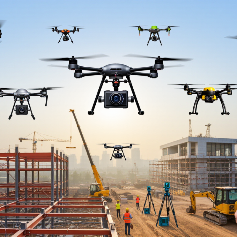
Construction drones in China are becoming practical surveying tools, not just flying cameras. Their value depends on reliable positioning, clear imagery, and repeatable flight plans. RTK positioning can improve location accuracy when satellite signals are available. Photogrammetry turns overlapping images into maps and 3D models. LiDAR helps capture structures and ground surfaces with less reliance on visible texture. Useful technology, but not magic.
On a busy site, a drone can document earthworks, check roof progress, and measure stockpiles from above. A weekly flight may reveal whether a roadbed has changed or materials have shifted. Thermal sensors can help locate heat loss or equipment hotspots during suitable inspections. These records give project teams another view of conditions. They do not replace close inspection or engineering judgment.
The strongest workflows connect flight data with surveying and construction records. Teams need trained pilots, consistent routes, and checks for blurred images or missing coverage. Dense buildings, cranes, dust, and poor weather can all reduce data quality. Small errors matter. A polished model can still mislead if its control points are weak. There is room for improvement here: sites may collect more data than they can interpret, so clear questions should guide each flight.
Choosing a leading Chinese construction drone manufacturer requires more than comparing flight range or advertised payload. Look for evidence that its aircraft fits real site work, such as mapping earthworks, inspecting roofs, or carrying sensors over uneven ground. Ask for test records from comparable environments, not just polished demonstration footage. Dust, wind, and repeated battery swaps expose weaknesses quickly.
Engineering depth matters. Review flight-control stability, obstacle sensing, positioning accuracy, and system behavior when a signal weakens. Request sample maps with stated ground resolution and checkpoints, along with maintenance intervals and spare-part lead times. A capable supplier should explain limitations plainly, including what operators must verify on site. Clear documentation counts.
Also assess production consistency and after-sales support. Examine quality-control steps, warranty terms, training materials, and the response process for a damaged arm or faulty sensor. Speak with customers who have used the equipment across a full season, where practical. One impressive flight proves little. No checklist is perfect. Smaller suppliers may offer attentive engineering yet have slower parts access; larger production capacity does not guarantee careful support. Compare verifiable records, then judge fit against the project’s terrain, workflow, and service needs.
China’s construction-drone makers span several distinct engineering profiles. Since company names are excluded, these ten profiles compare capabilities, not identifiable firms or a verified ranking. McKinsey Global Institute’s 2017 report estimated construction productivity grew about 1% annually over two decades, versus 2.8% across the economy. That gap helps explain demand for faster site measurement and progress checks.
One profile builds compact multirotors for frequent roof and façade inspections. Another specializes in RTK mapping for repeatable earthwork surveys; a third integrates LiDAR for dense terrain models. Heavy-lift designs prioritize payload capacity, while indoor models handle tight spaces beneath roofs. Thermal-imaging systems support checks for heat loss or equipment hotspots. Fixed-wing designs suit larger sites, though they need more room to launch. Rugged compact aircraft target small contractors. Long-endurance models reduce battery changes. Software-linked systems streamline flight planning and map delivery.
Useful distinctions. Yet specifications can flatter real performance. Wind, dust, occlusion, and operator skill affect results on a live site. Dodge Data & Analytics’ 2018 SmartMarket Report examined drone use in construction and reported perceived gains in safety and communication; those findings reflect surveyed users, not guaranteed outcomes. Buyers should compare usable flight time, positioning accuracy, repair access, and data-processing workflows under their own site conditions. A polished demo is not enough.
China’s construction-drone manufacturers differ in what they build and how well their systems fit daily site work. Some focus on mapping and surveying aircraft, while others offer platforms for material transport, progress photography, or equipment inspection. Compare payload, flight time, camera quality, and resistance to dust and wind. Field details matter. A drone that performs well over an open site may struggle near cranes, scaffolding, or changing work zones.
Manufacturing capability also includes more than the aircraft itself. Check whether a supplier provides flight-planning software, spare parts, operator training, and responsive technical support. Ask how quickly batteries can be replaced and whether imagery can be exported into the project’s existing mapping tools. A high payload figure alone can mislead; useful lift depends on battery life, distance, and site conditions. For surveying, prioritize repeatable image capture and accurate positioning. For inspections, consider stable close-range control and clear cameras. For transport, examine load-handling procedures and practical charging needs. Published specifications help, but they rarely show the full learning curve. A comparison should weigh verified field performance against the needs of a specific project, not just the most impressive brochure.
Representative endurance values by platform type, in minutes.
These indicative class-level values are not manufacturer-specific rankings. Actual flight time varies with payload, battery, weather, and mission conditions. Multirotors are commonly used for close-range site inspection and mapping; fixed-wing and VTOL platforms can cover larger areas for surveying and progress monitoring.
When comparing construction drone manufacturers in China, begin with the work the aircraft must do. A survey team needs stable positioning and clear image data; a site inspection crew may value obstacle sensing and a dependable zoom camera. Match the payload and flight time to a real shift, not an ideal test. Numbers are only a start.
Ask for test results under conditions close to your site, including wind, dust, and heat. Test it onsite. Check whether mapping files work with your existing software and whether battery changes are practical between flights. A drone that performs well in a showroom may be awkward beside scaffolding or moving equipment. That matters.
Look beyond the aircraft. Ask how technicians diagnose faults, how quickly common replacement parts can be supplied, and what operator training includes. Review warranty terms, maintenance schedules, and clear product documentation before committing. A responsive support team can prevent small issues from delaying a project. No shortcut exists. It is also sensible to speak with customers who use similar equipment, while remembering that one project’s experience may not fit yours. Even a careful evaluation leaves some uncertainty; plan a limited trial before placing a large order.
Ten practical criteria for comparing manufacturers. The rows are evaluation factors, not a ranked list of companies.
| No. | Selection factor | What to verify | Useful evidence or comparison method | Why it matters on construction projects |
|---|---|---|---|---|
| 1 | Regulatory compliance | Whether the aircraft and intended operation meet applicable Chinese civil aviation requirements. | Request applicable registration, product and operational documentation; confirm requirements with the Civil Aviation Administration of China (CAAC) or the relevant authority for the specific aircraft and use. | Requirements can vary by aircraft, operation and airspace. A supplier’s general compliance claim is not a substitute for checking the project’s actual obligations. |
| 2 | Payload and usable capacity | Maximum take-off mass, usable payload, and the effect of payload on flight time and stability. | Compare specification sheets and request a demonstration using the intended sensor or cargo, with payload and configuration recorded. | Survey cameras, LiDAR units and delivery loads have different weights and mounting needs; nominal payload alone does not establish mission suitability. |
| 3 | Flight time and mission coverage | Endurance under a stated payload, weather, flight profile and battery condition—not just an unloaded headline figure. | Ask for test conditions and compare completed area or mission time in a site trial. Include battery swaps and return-to-home reserves in planning. | Project coverage depends on actual site conditions, take-off locations, battery logistics and safe flight reserves. |
| 4 | Positioning and survey accuracy | Supported GNSS/RTK workflows, coordinate systems, control-point requirements and stated accuracy conditions. | Request a sample deliverable and validation report that identifies the reference system, ground control or check points, and processing method. | Mapping results depend on the complete workflow—including sensors, settings, site control and processing—not solely on the aircraft’s positioning specification. |
| 5 | Sensor and payload compatibility | Compatibility with required RGB, thermal, multispectral or LiDAR payloads, including interfaces and data formats. | Check supported payload lists, mounting and power limits, software versions, sample outputs and any required third-party integration. | Construction workflows may require different sensors for progress records, inspection, volumetric measurement or site mapping. |
| 6 | Environmental protection and durability | Published ingress-protection rating, operating temperature range, wind limits and maintenance guidance. | Request test documentation and read the rating’s stated scope. Under IEC 60529, an IP code describes enclosure protection against specified ingress conditions; it does not by itself certify overall suitability for every site condition. | Dust, rain, heat and wind can affect safe operation and equipment life. Use limits published for the complete aircraft and payload configuration. |
| 7 | Safety features and system reliability | Failsafe behavior, obstacle-sensing limits, lost-link procedures, flight logs and maintenance checks. | Review the operating and maintenance manuals, conduct a controlled demonstration, and document how the system responds to relevant faults. | Construction sites have changing obstacles, workers and equipment. Safety functions support—but do not replace—risk assessment and trained operation. |
| 8 | Software, data handling and integration | Supported mapping or inspection workflows, export formats, storage options, access controls and software update policy. | Test a sample project from capture to export; review data storage locations, account permissions, retention settings and integration requirements. | Project teams need usable outputs that fit existing design, GIS, asset-management or reporting processes, with data handling suited to project policies. |
| 9 | After-sales service and spare parts | Warranty terms, repair process, parts availability, technical support hours and service coverage for the project location. | Request written warranty and service terms, a parts list, repair turnaround expectations and references for comparable deployments. | A grounded aircraft or unavailable component can disrupt site work; service commitments should be clear and documented. |
| 10 | Training and total cost of ownership | Operator and maintenance training, included support, batteries, software fees, repairs and other recurring costs. | Compare itemized quotations over the planned ownership period and confirm training scope, prerequisites and refresher options. | Purchase price alone does not reflect operating costs or the time required to build a competent, safely managed team. |