How to Use a Photogrammetry Drone for Accurate 3D Mapping?
In recent years, the use of photogrammetry drones has transformed the field of 3D mapping. Experts highlight this technology's ability to capture high-resolution images from the sky, creating precise models of landscapes. Dr. Emily Carter, a leading expert in drone technology, states, “Photogrammetry drones are revolutionizing how we visualize and analyze spatial data.”
Using a photogrammetry drone involves several steps. It requires careful planning to ensure optimal flight paths and timing. Different environments present unique challenges, such as varying lighting conditions or obstacles. Sometimes, results can be less than perfect, requiring additional flights or adjustments to achieve accurate data capture.
Despite these challenges, photogrammetry drones provide unmatched benefits. They save time and resources compared to traditional surveying methods. Yet, it’s crucial for users to continuously learn and adapt to improve their skills. This evolving technology offers exciting possibilities, yet it demands critical thought and reflection on its applications and results.
Understanding Photogrammetry and Its Applications in 3D Mapping
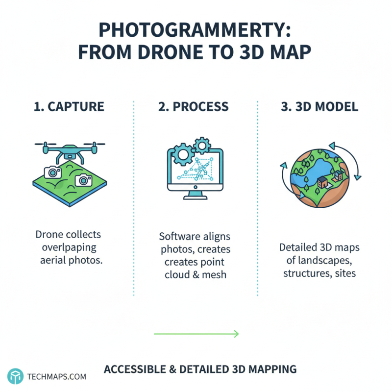
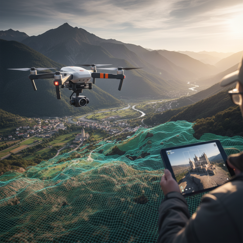
Photogrammetry is a powerful technique for creating 3D maps using aerial imagery. This method captures overlapping photographs from a drone, then processes them into detailed models. These models can showcase landscapes, structures, or archaeological sites. With the advent of technology, photogrammetry has become more accessible, but it still requires attention to detail.
While collecting images, drone pilots must ensure proper overlap. This overlap is crucial for the software to stitch images accurately. The drone should fly at a consistent altitude and speed. Adjusting camera settings is also vital. Poor lighting can lead to shadows that distort measurements. Misalignment during capturing can result in incomplete models, leaving gaps to reflect on.
Applications of photogrammetry extend across fields like surveying, agriculture, and environmental studies. In urban planning, it helps visualize proposed developments. However, the technology isn't flawless. Data accuracy can hinge on weather conditions and drone battery life. Capturing images during windy days might lead to shaky footage. Constant refinement of techniques is essential for achieving optimal results.
Choosing the Right Drone for Photogrammetry Tasks
Choosing the right drone for photogrammetry tasks is crucial. Different drones offer various capabilities. The choice greatly impacts data accuracy and project success. According to a study from Drone Industry Insights, the market for photogrammetry is expected to grow by 20% annually. Understanding specific needs can help in selecting the best drone.
When evaluating drones, consider payload capacity, camera quality, and battery life. Many drones have optimized features for aerial mapping. Look for high-resolution cameras. A 20-megapixel camera can capture detailed images suitable for 3D models. Battery life should provide sufficient flight time for the area being surveyed. Shorter flight times may require more frequent recharges, leading to downtime.
Budget and training are also factors. More advanced drones can be expensive, and additional software may be necessary for processing. Simple drones are easier to fly but may lack certain features. Industry reports suggest that trained drone operators improve data accuracy by 30%. Investing in good training can be as valuable as the drone itself. Consider these aspects to ensure that the drone you choose fits your specific project requirements.
How to Use a Photogrammetry Drone for Accurate 3D Mapping? - Choosing the Right Drone for Photogrammetry Tasks
| Drone Model |
Camera Resolution |
Max Flight Time |
GPS Accuracy |
Price Range |
| Model A |
20 MP |
30 min |
±2 m |
$1500 - $2000 |
| Model B |
24 MP |
35 min |
±1.5 m |
$2000 - $2500 |
| Model C |
30 MP |
40 min |
±1 m |
$2500 - $3000 |
| Model D |
16 MP |
25 min |
±3 m |
$1000 - $1500 |
Essential Equipment and Software for Photogrammetry Projects
When embarking on photogrammetry projects, choosing the right equipment is vital.
Drones equipped with high-resolution cameras are essential for capturing detailed aerial images. Ideally, these drones should have stable
GPS systems to ensure accurate positioning. A strong battery life is also necessary, as lengthy flights produce more data.
It's wise to consider backup batteries to avoid interruptions during the mapping process.
In addition to drones, having reliable software for processing images is crucial. The software should enable stitching images together to build a 3D model.
Look for programs with user-friendly interfaces. However, these tools can have a learning curve. This might slow down initial progress but is important for precise results.
Collaboration with knowledgeable users can help navigate this tricky aspect.
Don’t forget about ground control points (GCPs). They enhance the accuracy of your data. Using markers in the field can greatly improve
your mapping quality. Sometimes, weather conditions present challenges. Cloudy days may reduce light quality for image capture. Patience is key
in this evolving field. As technology advances, staying informed will be essential for success.
Step-by-Step Guide to Capturing Data with a Photogrammetry Drone
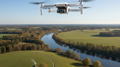
Using a photogrammetry drone for 3D mapping begins with proper planning. Identify the area you want to capture. Create a flight plan that covers all critical sections. Ensure you have clear weather. Wind can impact flight stability and data quality. Consider the time of day. Lighting conditions are crucial for capturing sharp images.
Next, set up your drone according to the plan. Check battery levels and camera settings before takeoff. Adjust your drone's altitude for better coverage. Take overlapping images to improve data accuracy. Pictures should overlap by at least 70%. This creates more reference points for the software. When flying, hover in key areas. This ensures you capture essential details.
After data collection, upload images to photogrammetry software. Processing time may vary. Be prepared for potential errors in the data. Sometimes, issues arise from blurred images or poor overlaps. Review your results carefully. Consider going out again if needed. Fine-tuning is often necessary for precise maps.
3D Mapping Accuracy of Photogrammetry Drones
This chart shows the accuracy percentage of 3D mapping produced by different conditions using photogrammetry drones over a series of trials.
Processing and Analyzing Your Data for Accurate 3D Models
Processing and analyzing data from photogrammetry drones is crucial for creating accurate 3D models. Begin by ensuring that the images captured are of high quality. According to industry studies, drone imagery with proper overlap and varied angles enhances model accuracy by over 30%. Use software that can efficiently process these images. Yet, many users still struggle with software settings, often leading to poor model outputs.
After processing, it's essential to cross-check the generated 3D models with ground control points (GCPs). This step is often overlooked. A study by the American Society for Photogrammetry indicates that skipping GCPs can introduce errors exceeding 5%. Calibration of these points during the model comparison phase is vital. Users may find themselves repeatedly refining their techniques, as initial outputs rarely meet professional standards.
Further analysis involves assessing the model's fidelity and usability. Users should be aware that digital models can vary in resolution. Resolutions that exceed the required level may lead to unnecessary processing times. Moreover, not all processing errors are easily detectable. Many still find themselves rethinking their methodologies, searching for a balance between speed and accuracy.