Best Lidar Drone Options for Accurate Mapping and Surveying?
In the rapidly evolving field of survey technology, lidar drones have emerged as essential tools for accurate mapping and data collection. Renowned expert Dr. Emily Chen points out, "Lidar drones revolutionize how we capture spatial data." This technology enables users to survey large areas with remarkable precision and efficiency.
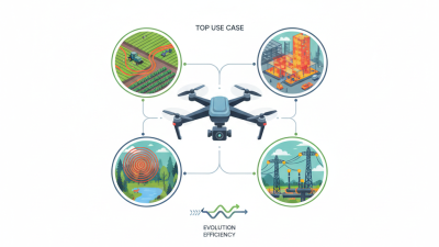
The advantages of lidar drones extend beyond simple mapping. They facilitate environmental monitoring, infrastructure inspections, and disaster management. By harnessing advanced laser scanning technology, these drones can create detailed 3D models of landscapes and structures. This capability allows professionals to make informed decisions based on visual data.
However, selecting the right lidar drone can be daunting. Various models exist, each offering unique features and specifications. Factors such as flight time, sensor quality, and ease of use are critical considerations. As the industry grows, users must reflect on their specific needs and the potential limitations of lidar drones. Exploring options carefully ensures optimal results in their projects.

Overview of Lidar Technology in Drone Applications
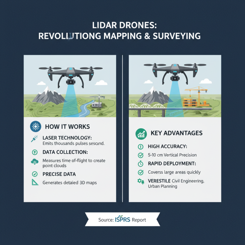
Lidar technology has transformed drone applications in mapping and surveying. By using laser pulses, Lidar can capture detailed topographic data. This system allows for precise measurements of terrain, vegetation, and buildings. Drones equipped with Lidar sensors fly over an area, gathering data rapidly. This process generates highly accurate 3D models of the landscape.
One downside is the potential for data misinterpretation. While Lidar is effective, it requires skilled operators to analyze the results. Inexperience can lead to errors in mapping. Factors like weather conditions also affect the accuracy of Lidar readings. A heavy canopy can obstruct signals, leading to incomplete data. Operators must consider these limitations when planning flights.
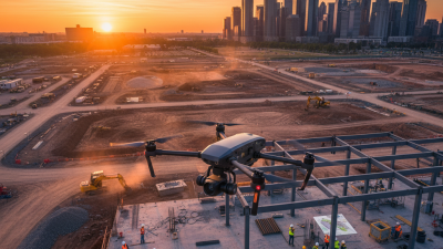
Furthermore, operating Lidar-equipped drones can be costly. The technology involves expensive sensors and software. Not all projects can justify these costs. Smaller surveys may benefit more from traditional methods. However, when accuracy is paramount, Lidar shines. Its ability to deliver intricate detail makes it invaluable in certain contexts. For projects that require precision, the investment may be worth it.
Key Features to Consider in Lidar Drones for Mapping
When considering lidar drones for mapping, several key features stand out. First, the sensor resolution is crucial. High-resolution sensors capture detailed data, which results in more accurate models. It's essential to check the specifications. Some drones offer varying resolutions. A higher resolution is better but may increase costs.
Another important feature is flight time. Drones with longer battery life can cover more area in a single flight. This reduces downtime for charging and allows for efficient mapping. Look for models that provide at least 30-40 minutes of operation. However, longer flights may come at the expense of weight and portability.
Lastly, consider the software compatibility. Lidar data processing software can vary significantly. Make sure the drone you choose integrates seamlessly with popular mapping and surveying software. This ensures a smoother workflow. Some drones may have limited software options, leading to frustrations later on. Evaluate what your specific needs are and match them accordingly.
Top Lidar Drone Models for Precision Surveying
Lidar drones have revolutionized the field of mapping and surveying. These advanced devices use laser technology to collect precise data. According to a report from the International Society of Photogrammetry and Remote Sensing, Lidar can achieve vertical accuracies of 5-10 centimeters. This accuracy is vital for applications in forestry and civil engineering.
Among top models, some offer enhanced scanning capabilities. A study from the Journal of Applied Remote Sensing highlighted that drones equipped with dual-laser systems provide improved coverage and efficiency. This leads to better data collection over vast terrains. Nonetheless, many users struggle with data processing after collection. Software can be complex, causing delays in project timelines.
Battery life also remains a challenge. Many high-performance Lidar drones can fly only for 30-50 minutes. This limits operational range and requires strategic planning. Adapting to these constraints may not be easy for newcomers. Yet, understanding these limitations leads to better preparedness in fieldwork.
Comparative Analysis of Price and Performance for Lidar Drones
When it comes to accurate mapping and surveying, lidar drones offer a range of options. Price varies significantly among different models. Some units are budget-friendly while others are premium in cost. This variation often reflects the capabilities each drone offers.
Performance is another crucial factor. Higher-end models might provide enhanced resolution and faster data acquisition. They can also handle complex terrains better. Yet, some affordable drones still deliver adequate results for smaller projects. Analyzing your specific needs is essential. It helps you balance cost against the necessary features.
Many users report mixed experiences with lidar drones. Some models may struggle in areas with dense vegetation. Others might show inconsistencies in data quality under certain conditions. These imperfections highlight the importance of field testing. Understanding the terrain and project goals can help guide your choice. Ultimately, selecting the right lidar drone requires careful consideration of both price and performance.
Future Trends in Lidar Drone Technology for Surveying and Mapping
The future of lidar drone technology is promising. As advancements continue, precision in mapping and surveying will improve. Enhanced sensors are being developed. These new sensors can capture more data per flight. The potential for real-time processing of that data is also increasing. This could revolutionize how surveys are conducted.
There are challenges too. Integration with existing systems can be difficult. Not all drones can support advanced lidar technologies. In many cases, software solutions lag behind hardware advancements. Users may need to invest heavily in updates. Training the workforce is another hurdle. Keeping up with fast-changing technology can be overwhelming.
Yet, the benefits are clear. Accurate topographical maps will lead to better decision-making. Increased efficiency in data collection can save time and resources. As users see the value, they may overcome the initial barriers. Embracing these innovations can transform industries that rely heavily on mapping and surveying. The road ahead is exciting but challenging.
Best Lidar Drone Options for Accurate Mapping and Surveying